GerVian.com


|
Rich History, Unspoilt Setting
Leyte is one of the country's historic provinces. It is the site of
uprising against the Spaniards and the famous landing of US forces during
World War II.
This historical consciousness is reflected in Leyte's
seal, with stars symbolizing the 49 towns of the province and an alphabet on
cross argent representing the ancient letter L. A white cross
indicates the second phase of Leyte's development, when Magellan passed
through enroute to Cebu; while the upper portion commemorates the landing of
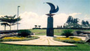
Gen. Douglas McArthur through a perspective of the National Freedom Park.
The capital city of Tacloban is the most important seaport on the eastern
coast, while Ormoc City is the outlet on the western coast. |
 |
|
BRIEF HISTORY
In 1595, the Jesuits established the first mission in Leyte. At this
time, there were only 19 pueblos with 70,000 people whom the
missionaries converted to Christianity, easing the settlement of the
province by Spanish conquestadores. The Jesuit mission was
abandoned when the Order was expelled from the Philippines in 1768.
Politically, Leyte seems to have existed as early as 1622. The simple
structure of government by encomenderos gave way to alcalde
mayores, corregidores and tenientes. In 1735, Leyte was a
politico-military province with jurisdiction over Samar. The two
provinces were politically separated in 1768 by Royal Decree of July 31,
1860 which ordered the reorganization of provincial governments of the
Visayas.
The capital site of Leyte changed several times before Tacloban City became
the permanent capital in 1787. The first capital was Carigara, then
successively Palo and Tanauan.
The civil government under the American was organized on April 22, 1901.
The second World War hit the Philippines in 1941; the Japanese occupation
followed. In 1944, Leyte became world-famous as the point of entry for
the American forces of liberation. Leyte, specifically Tacloban,
assumed historical significance as the temporary seat of the Philippine
Commonwealth from October 23, 1944 to February 27, 1945.
|
|
Click here to
view the various tourist attractions of this province!

F A S T F A C T S
|
CAPITAL
Tacloban
- - - - - - - - - - - -
LOCATION
N - Carigara Bay
E - San Juanico Strait
and Leyte Gulf
W - Visayan Sea and
Ormoc Sea
S - Southern Leyte
- - - - - - - - - - - -
LAND AREA
5,712.8 sq. kms.
- - - - - - - - - - - -
NO. OF TOWNS
41 (forty-one)
- - - - - - - - - - - -
CITIES
Tacloban & Ormoc
- - - - - - - - - - - -
POPULATION
1,511,251
(as of 1995 census)
- - - - - - - - - - - -
CLIMATE
In Leyte, heavy rains
occur between November and February; while March to April and August to
September are the driest months.
- - - - - - - - - - - -
TOPOGRAPHY
The terrain of the
province is relatively flat to gently rolling and becoming mountainous and
rough towards the center where a mountain range begins.
Many low mountains ranges traverse Leyte just like Samar and Visayan
Islands. From the northwestern section to the southeastern extremities
extends a very rugged, almost impassable ridge; there are also many extinct
volcanoes, of which the most important is Mahagnao.
- - - - - - - - - - - -
DIALECTS
Waray-waray
Cebuano
- - - - - - - - - - - -
TOURIST ASSISTANCE OFFICE
Provincial Tourism Office
Leyte Provincial Capitol
Tacloban City
Tel. No.: (053) 321-4927
(053) 325-9646
Fax No. (053) 325-5156
- - - - - - - - - - - -
|
|
|